
Land Use Plan for District Toba Tek Singh
local governments of District Toba Tek Singh
- Land Use Classification Map/s
- Enlistment of Commercial Roads
- SDZ/s Structure Plan/s
Union Associates prepares land use classification maps, commercial road enlistments and SDZ structure plans for district and municipal governments in Punjab. 60 projects to date: 32 completed, 28 ongoing.
Union Associates has been engaged by a District Council, a Municipal Corporation and a set of district local governments in Punjab. The project record runs from 2021 to 2023.
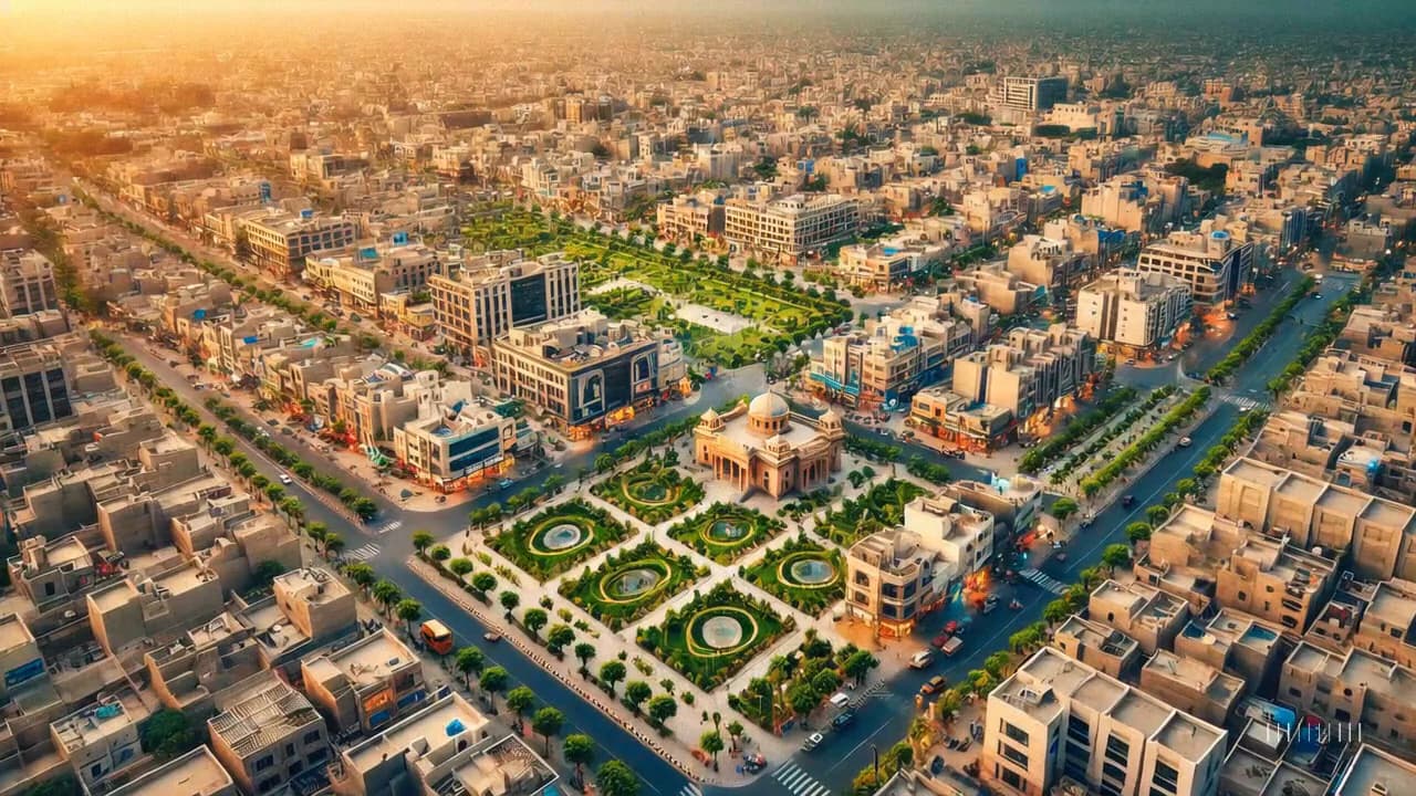
Two aerial photographs of ordinary places. In one the street pattern was settled on a drawing and the blocks were built into it; in the other it was worked out on the ground, plot by plot, in the order the land was occupied. Access, frontage and service corridors all follow from which of the two happened.
 Planned grid
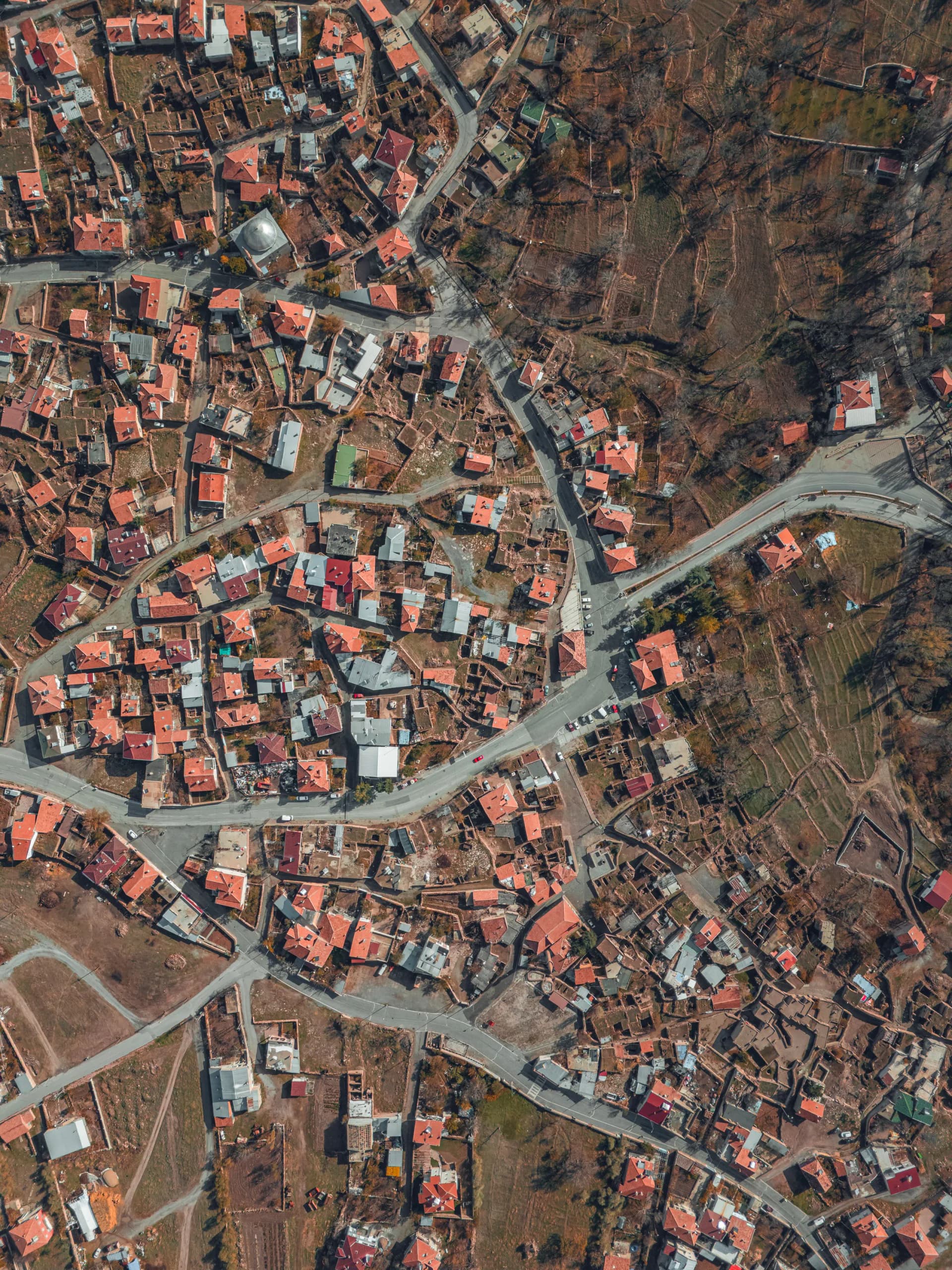 Unplanned settlement
Both patterns are ordinary and both occur everywhere. The difference a land use plan makes is not that one looks tidier — it is that the geometry of the first was settled before it was built, and the geometry of the second has to be worked out afterwards, against what is already standing.
Both photographs are licensed stock, used to illustrate urban form. Neither was taken in Pakistan and neither shows a project by this practice. The overlay is a schematic reading of the street pattern, not a survey of either site.
Land use planning, urban design, transport and environmental planning, feasibility studies, GIS mapping and surveying, and regulatory compliance — issued from a single geodatabase so the deliverables cannot contradict each other.
Urban planning and design intertwines the connections between people, nature, and the built environment within a city.
Urban design encompasses the art and science of shaping the physical form and functionality of cities.
Transport and environmental planning converge to shape sustainable urban landscapes by balancing mobility needs with environmental preservation.
Feasibility studies in town planning are crucial assessments conducted to evaluate the viability and potential success of proposed development projects or urban interventions.
Efficient city administration hinges on robust planning, driven by accurate data. Geographical Information System (GIS) has emerged as a vital tool, integrating diverse data sources for informed urban decision-making.
Regulatory compliance in planning and governance ensures adherence to laws, regulations, and standards governing urban development.
A surveyed boundary, a road hierarchy, blocks and their plot subdivision, a use category carried across every parcel, and the commercial frontage enlisted against each road — built up in that sequence, on one coordinate system, so a change to any layer is a change to all of them.
Land use
Network
District Council Multan, the local governments of District Toba Tek Singh, and Municipal Corporation Gujranwala — each with the deliverables the engagement actually produced, listed as the client received them.
local governments of District Toba Tek Singh
District Council Multan
Municipal Corporation Gujranwala
Every named engagement on this site is with a district or municipal body in Punjab. That is the reader the deliverables are written for, and it is the review the drawings have to pass.
District Council Multan
Land Use Plan for Multan2022–2023
Municipal Corporation Gujranwala
Land Use Classification Map for Gujranwala2021
local governments of District Toba Tek Singh
Land Use Plan for District Toba Tek Singh2022–2023
Four steps, in this order, on every engagement. The sequence exists because a plan drawn before the governing rule is read is a plan that gets redrawn after review.
Which rules apply to this land: the notified classification, the applicable LDA or Punjab housing scheme rules, and any earlier plan still on the record. A plan drawn against a superseded rule fails at scrutiny, not at drafting.
Field capture and digitisation of whatever spatial data the district already holds, reconciled rather than replaced, into a single project geodatabase that every subsequent map is generated from.
Land use classification across the district, enlistment of the roads that may carry commercial use with the assessment attached to each, and structure plans for the special development zones.
The plan is assembled the way the council has to consider it — maps, schedules and the reasoning behind each contested decision — so an objection can be answered from the file.
The LDA regulations and the Punjab private housing scheme rules that govern land use, sub-division and building approval, republished here as PDFs so the rule can be read rather than paraphrased.
A tender reference, a district name or a two-line description is enough to start. We reply with the deliverable set the work would need and what we would want from your office to begin.